
Make a donation
Gear up for your next adventure:
As an Amazon Associate, this site earns from qualifying purchases at no extra cost to you.
South Rodanthe topographic map
Click on the map to display elevation.
Make a donation
Gear up for your next adventure:
As an Amazon Associate, this site earns from qualifying purchases at no extra cost to you.
About this map
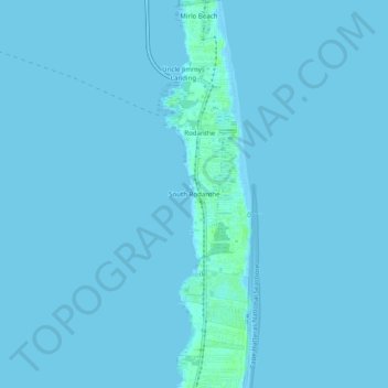
Name: South Rodanthe topographic map, elevation, terrain.
Average elevation: 3 ft
Minimum elevation: -3 ft
Maximum elevation: 23 ft
Dare County trails, hiking, mountain biking, running and outdoor activities
Make a donation
Gear up for your next adventure:
As an Amazon Associate, this site earns from qualifying purchases at no extra cost to you.
Other topographic maps
Click on a map to view its topography, its elevation and its terrain.
Kitty Hawk
United States > North Carolina > Dare County
Kitty Hawk is located at 36°06′N 75°42′W / 36.1°N 75.7°W / 36.1; -75.7 at an elevation of 7 feet (2 m) above sea level.
Average elevation: 7 ft