
Make a donation
Gear up for your next adventure:
As an Amazon Associate, this site earns from qualifying purchases at no extra cost to you.
Comuna 7 topographic map
Click on the map to display elevation.
Make a donation
Gear up for your next adventure:
As an Amazon Associate, this site earns from qualifying purchases at no extra cost to you.
About this map
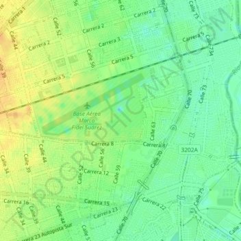
Name: Comuna 7 topographic map, elevation, terrain.
Average elevation: 3,130 ft
Minimum elevation: 3,081 ft
Maximum elevation: 3,179 ft
Make a donation
Gear up for your next adventure:
As an Amazon Associate, this site earns from qualifying purchases at no extra cost to you.
Other topographic maps
Click on a map to view its topography, its elevation and its terrain.
Parque La Flora
Colombia > Valle del Cauca > Cali > Perímetro Urbano Santiago de Cali
Average elevation: 3,271 ft
San Antonio
Colombia > Valle del Cauca > Cali > Perímetro Urbano Santiago de Cali
Average elevation: 3,419 ft
Parque de las iguanas
Colombia > Valle del Cauca > Cali > Perímetro Urbano Santiago de Cali
Average elevation: 3,146 ft