
Thank you for supporting this site ❤️
Make a donation
Make a donation
Gear up for your next adventure:
As an Amazon Associate, this site earns from qualifying purchases at no extra cost to you.
Hochwäldli topographic map
Click on the map to display elevation.
Thank you for supporting this site ❤️
Make a donation
Make a donation
Gear up for your next adventure:
As an Amazon Associate, this site earns from qualifying purchases at no extra cost to you.
About this map
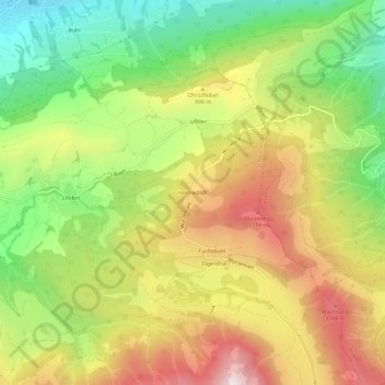
Name: Hochwäldli topographic map, elevation, terrain.
Location: Hochwäldli, Schwarzenberg, Lucerne, 6013, Suisse (46.99620 8.18789 47.03620 8.22789)
Average elevation: 2,936 ft
Minimum elevation: 1,677 ft
Maximum elevation: 4,334 ft
Thank you for supporting this site ❤️
Make a donation
Make a donation
Gear up for your next adventure:
As an Amazon Associate, this site earns from qualifying purchases at no extra cost to you.