
Thank you for supporting this site ❤️
Make a donation
Make a donation
Gear up for your next adventure:
As an Amazon Associate, this site earns from qualifying purchases at no extra cost to you.
Abdon topographic map
Click on the map to display elevation.
Thank you for supporting this site ❤️
Make a donation
Make a donation
Gear up for your next adventure:
As an Amazon Associate, this site earns from qualifying purchases at no extra cost to you.
About this map
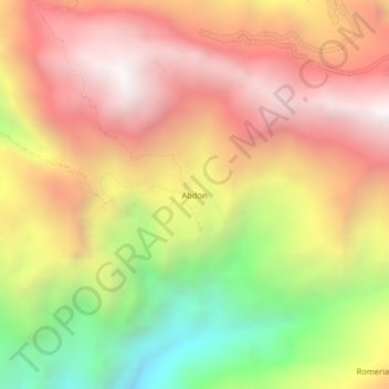
Name: Abdon topographic map, elevation, terrain.
Location: Abdon, Longotea, Province of Bolívar, La Libertad, Peru (-7.09183 -77.89411 -7.05183 -77.85411)
Average elevation: 9,577 ft
Minimum elevation: 6,165 ft
Maximum elevation: 12,215 ft
Thank you for supporting this site ❤️
Make a donation
Make a donation
Gear up for your next adventure:
As an Amazon Associate, this site earns from qualifying purchases at no extra cost to you.