
Thank you for supporting this site ❤️
Make a donation
Make a donation
Gear up for your next adventure:
As an Amazon Associate, this site earns from qualifying purchases at no extra cost to you.
Senapati topographic map
Click on the map to display elevation.
Thank you for supporting this site ❤️
Make a donation
Make a donation
Gear up for your next adventure:
As an Amazon Associate, this site earns from qualifying purchases at no extra cost to you.
About this map
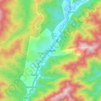
Name: Senapati topographic map, elevation, terrain.
Location: Senapati, Senapati tehsil, Senapati District, Manipur, India (25.23266 93.98675 25.31266 94.06675)
Average elevation: 4,334 ft
Minimum elevation: 3,274 ft
Maximum elevation: 5,883 ft
Thank you for supporting this site ❤️
Make a donation
Make a donation
Gear up for your next adventure:
As an Amazon Associate, this site earns from qualifying purchases at no extra cost to you.