
Make a donation
Gear up for your next adventure:
As an Amazon Associate, this site earns from qualifying purchases at no extra cost to you.
Hemmerde topographic map
Click on the map to display elevation.
Make a donation
Gear up for your next adventure:
As an Amazon Associate, this site earns from qualifying purchases at no extra cost to you.
About this map
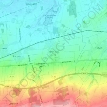
Name: Hemmerde topographic map, elevation, terrain.
Location: Hemmerde, Unna, Kreis Unna, Nordrhein-Westfalen, Deutschland (51.51318 7.79397 51.57863 7.84294)
Average elevation: 384 ft
Minimum elevation: 223 ft
Maximum elevation: 761 ft
Make a donation
Gear up for your next adventure:
As an Amazon Associate, this site earns from qualifying purchases at no extra cost to you.
Other topographic maps
Click on a map to view its topography, its elevation and its terrain.
Billmerich
Deutschland > Nordrhein-Westfalen > Kreis Unna > Unna
In Billmericher Steinbrüchen sind die verschiedenen Gesteinsschichten deutlich zu erkennen. Die Kreide aus den Kalkmergelsteinbänken, der an fast allen höher gelegenen Stellen in Billmerich vorkommt, wurde auf den Feldern zum Düngen verwendet. In den 7 größeren und in einigen kleineren Steinbrüchen…
Average elevation: 505 ft
Make a donation
Gear up for your next adventure:
As an Amazon Associate, this site earns from qualifying purchases at no extra cost to you.