Geolocate

Cojitambo topographic map

Click on the map to display elevation.

About this map

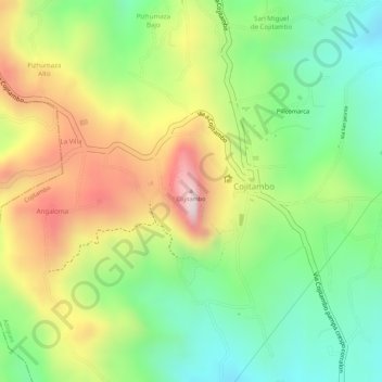
Name: Cojitambo topographic map, elevation, terrain.

Location: Cojitambo, Azogues, Cañar, 030101, Ecuador (-2.75946 -78.88872 -2.75936 -78.88862)

Average elevation: 9,275 ft

Minimum elevation: 8,658 ft

Maximum elevation: 10,026 ft

Gear up for your next adventure:

🪶Thermal Camp Blanket - Extra warmth for cold nights
🪑Ultralight Camp Chairs - Portable seating for resting after a long day of mapping
🧭Orienteering Set - Complete compass and map reading kit
GPS Sports Watch - GPS watch for running, hiking and training
🪶Multi‑Purpose Knife - Useful blade for camp and trail

As an Amazon Associate, this site earns from qualifying purchases at no extra cost to you.