Geolocate

Offham topographic map

Click on the map to display elevation.

About this map

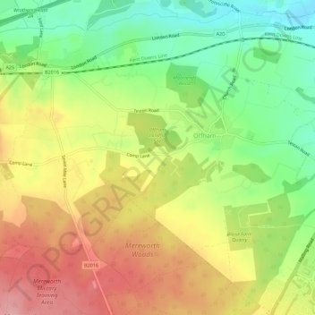
Name: Offham topographic map, elevation, terrain.

Location: Offham, Tonbridge and Malling, Kent, England, United Kingdom (51.27476 0.33968 51.30105 0.39536)

Average elevation: 315 ft

Minimum elevation: 115 ft

Maximum elevation: 515 ft

Gear up for your next adventure:

🛌Ultralight Sleeping Bags - Compact down bags for cold nights in the wilderness
🧭GPS Watch Accessories - Bands and chargers for GPS watches
🪄Magnetic Compass - Accurate compass for navigation
🖼️Topo Map Wall Art - Decorative topographic prints of famous peaks and regions
🦺Reflective Outdoor Gear - Safety gear for low‑light conditions

As an Amazon Associate, this site earns from qualifying purchases at no extra cost to you.