Geolocate

Rewalsar topographic map

Click on the map to display elevation.

Rewalsar

Rewalsar is located at an altitude of 1360 m above sea level. It is connected to Mandi by a motorable road and is about 25 km from Mandi. Lying in the Southern Himalayan belt, winters in Rewalsar can be freezing, while summers are generally pleasant.

Wikipedia (CC-BY-SA 3.0)

About this map

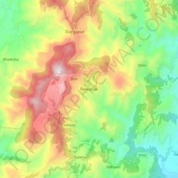
Name: Rewalsar topographic map, elevation, terrain.

Location: Rewalsar, Mandi, Mandi District, Himachal Pradesh, 175023, India (31.59248 76.79330 31.67248 76.87330)

Average elevation: 4,209 ft

Minimum elevation: 2,671 ft

Maximum elevation: 6,322 ft

Gear up for your next adventure:

🛡️Bear Spray Outdoor - Protection in bear country hikes
🗻Climbing Gear Basics - Essential gear for beginner climbers
🗺️Topographic Maps - Detailed topo maps for hiking, exploring and outdoor navigation
🚪Portable Camp Chair - Foldable chair for comfort at camp
🩹Survival Bandages - High‑quality bandages for emergencies

As an Amazon Associate, this site earns from qualifying purchases at no extra cost to you.