Geolocate

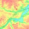
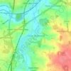
Wortwell topographic map

Click on the map to display elevation.

About this map

Name: Wortwell topographic map, elevation, terrain.

Location: Wortwell, South Norfolk, Norfolk, England, United Kingdom (52.40132 1.32234 52.42545 1.36128)

Average elevation: 72 ft

Minimum elevation: 26 ft

Maximum elevation: 138 ft

Other topographic maps

Click on a map to view its topography, its elevation and its terrain.
Welborne

United Kingdom > England > Norfolk > South Norfolk

Average elevation: 157 ft

Harleston

United Kingdom > England > Norfolk > South Norfolk

Average elevation: 121 ft

Trowse

United Kingdom > England > Norfolk > South Norfolk

Average elevation: 75 ft

Marlingford

United Kingdom > England > Norfolk > South Norfolk

Average elevation: 112 ft

Chapel Hill

United Kingdom > England > Norfolk > South Norfolk

Average elevation: 59 ft

Fersfield

United Kingdom > England > Norfolk > South Norfolk > Fersfield

Average elevation: 148 ft

Burston

United Kingdom > England > Norfolk > South Norfolk

Average elevation: 131 ft

Deopham Green

United Kingdom > England > Norfolk > South Norfolk > Deopham

Average elevation: 167 ft

Morningthorpe

United Kingdom > England > Norfolk > South Norfolk

Average elevation: 151 ft

Morley St Peter

United Kingdom > England > Norfolk > South Norfolk

Average elevation: 157 ft

Thorpe Abbotts

United Kingdom > England > Norfolk > South Norfolk

Average elevation: 131 ft

Hapton

United Kingdom > England > Norfolk > South Norfolk

Average elevation: 121 ft

Kirby Row

United Kingdom > England > Norfolk > South Norfolk > Kirby Cane

Average elevation: 52 ft

Hethel

United Kingdom > England > Norfolk > South Norfolk

Average elevation: 154 ft

Sneath Common

United Kingdom > England > Norfolk > South Norfolk

Average elevation: 167 ft

Keswick

United Kingdom > England > Norfolk > South Norfolk

Average elevation: 75 ft

Tharston

United Kingdom > England > Norfolk > South Norfolk

Average elevation: 121 ft

Lushbush

United Kingdom > England > Norfolk > South Norfolk > Harleston

Average elevation: 108 ft

Thorpe Abbotts

United Kingdom > England > Norfolk > South Norfolk

Average elevation: 131 ft

Harleston

United Kingdom > England > Norfolk > South Norfolk

Average elevation: 121 ft

Surlingham

United Kingdom > England > Norfolk > South Norfolk

Average elevation: 39 ft

Gear up for your next adventure:

⛺Backpacking Tents - Weight-optimized shelters for multi-day topographic surveys
🧼Biodegradable Camping Soap - Eco‑friendly soap for outdoor hygiene
🎒Waterproof Dry Bags - Keep your electronics and maps dry inside your pack
🥇GPS Hiking Watch - Multi‑sport GPS watch with navigation and trail tracking
🛡️Bear Spray Outdoor - Protection in bear country hikes

As an Amazon Associate, this site earns from qualifying purchases at no extra cost to you.