
Thank you for supporting this site ❤️
Make a donation
Make a donation
Gear up for your next adventure:
As an Amazon Associate, this site earns from qualifying purchases at no extra cost to you.
Huancapallac topographic map
Click on the map to display elevation.
Thank you for supporting this site ❤️
Make a donation
Make a donation
Gear up for your next adventure:
As an Amazon Associate, this site earns from qualifying purchases at no extra cost to you.
About this map
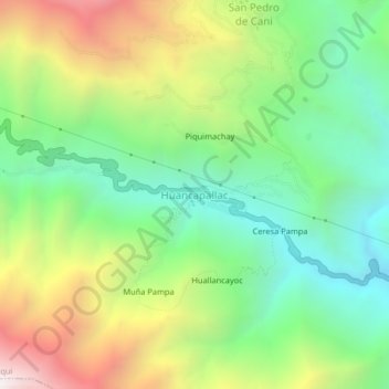
Name: Huancapallac topographic map, elevation, terrain.
Location: Huancapallac, Quisqui, Huánuco, Perú (-9.92463 -76.41241 -9.88463 -76.37241)
Average elevation: 9,295 ft
Minimum elevation: 7,274 ft
Maximum elevation: 12,582 ft
Thank you for supporting this site ❤️
Make a donation
Make a donation
Gear up for your next adventure:
As an Amazon Associate, this site earns from qualifying purchases at no extra cost to you.