
Thank you for supporting this site ❤️
Make a donation
Make a donation
Gear up for your next adventure:
As an Amazon Associate, this site earns from qualifying purchases at no extra cost to you.
Jianying topographic map
Click on the map to display elevation.
Thank you for supporting this site ❤️
Make a donation
Make a donation
Gear up for your next adventure:
As an Amazon Associate, this site earns from qualifying purchases at no extra cost to you.
About this map
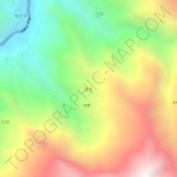
Name: Jianying topographic map, elevation, terrain.
Location: Jianying, Dêrong County, Kardze, Sichuan, 627900, China (28.51091 99.27447 28.55091 99.31447)
Average elevation: 10,351 ft
Minimum elevation: 7,152 ft
Maximum elevation: 14,157 ft
Thank you for supporting this site ❤️
Make a donation
Make a donation
Gear up for your next adventure:
As an Amazon Associate, this site earns from qualifying purchases at no extra cost to you.