
Thank you for supporting this site ❤️
Make a donation
Make a donation
Gear up for your next adventure:
As an Amazon Associate, this site earns from qualifying purchases at no extra cost to you.
Posets topographic map
Click on the map to display elevation.
Thank you for supporting this site ❤️
Make a donation
Make a donation
Gear up for your next adventure:
As an Amazon Associate, this site earns from qualifying purchases at no extra cost to you.
About this map
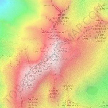
Name: Posets topographic map, elevation, terrain.
Location: Posets, Sahún, Ribagorce, Huesca, Aragon, 22469, Espagne (42.65458 0.43517 42.65468 0.43527)
Average elevation: 9,488 ft
Minimum elevation: 7,011 ft
Maximum elevation: 11,027 ft
Thank you for supporting this site ❤️
Make a donation
Make a donation
Gear up for your next adventure:
As an Amazon Associate, this site earns from qualifying purchases at no extra cost to you.