
Thank you for supporting this site ❤️
Make a donation
Make a donation
Gear up for your next adventure:
As an Amazon Associate, this site earns from qualifying purchases at no extra cost to you.
I Nonni topographic map
Click on the map to display elevation.
Thank you for supporting this site ❤️
Make a donation
Make a donation
Gear up for your next adventure:
As an Amazon Associate, this site earns from qualifying purchases at no extra cost to you.
About this map
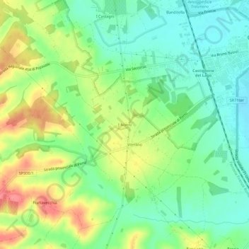
Name: I Nonni topographic map, elevation, terrain.
Location: I Nonni, Castiglione del Lago, Perugia, Umbria, 06061, Italia (43.09370 11.99485 43.13370 12.03485)
Average elevation: 938 ft
Minimum elevation: 840 ft
Maximum elevation: 1,089 ft
Thank you for supporting this site ❤️
Make a donation
Make a donation
Gear up for your next adventure:
As an Amazon Associate, this site earns from qualifying purchases at no extra cost to you.