
Thank you for supporting this site ❤️
Make a donation
Make a donation
Gear up for your next adventure:
As an Amazon Associate, this site earns from qualifying purchases at no extra cost to you.
Fórnea topographic map
Click on the map to display elevation.
Thank you for supporting this site ❤️
Make a donation
Make a donation
Gear up for your next adventure:
As an Amazon Associate, this site earns from qualifying purchases at no extra cost to you.
About this map
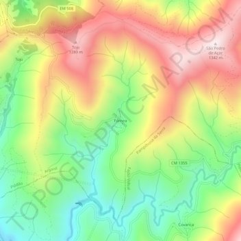
Name: Fórnea topographic map, elevation, terrain.
Location: Fórnea, Piódão, Arganil, Coimbra, 3305-242, Portugal (40.18285 -7.85873 40.22285 -7.81873)
Average elevation: 3,123 ft
Minimum elevation: 2,018 ft
Maximum elevation: 4,383 ft
Thank you for supporting this site ❤️
Make a donation
Make a donation
Gear up for your next adventure:
As an Amazon Associate, this site earns from qualifying purchases at no extra cost to you.