
Thank you for supporting this site ❤️
Make a donation
Make a donation
Gear up for your next adventure:
As an Amazon Associate, this site earns from qualifying purchases at no extra cost to you.
Khanom topographic map
Click on the map to display elevation.
Thank you for supporting this site ❤️
Make a donation
Make a donation
Gear up for your next adventure:
As an Amazon Associate, this site earns from qualifying purchases at no extra cost to you.
About this map
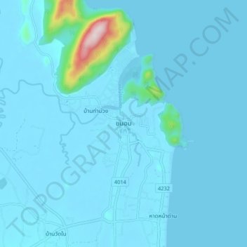
Name: Khanom topographic map, elevation, terrain.
Location: Khanom, Ao Khanom, Nakhon Si Thammarat Province, 80210, Thailand (9.17488 99.82035 9.25488 99.90035)
Average elevation: 89 ft
Minimum elevation: -3 ft
Maximum elevation: 1,673 ft
Thank you for supporting this site ❤️
Make a donation
Make a donation
Gear up for your next adventure:
As an Amazon Associate, this site earns from qualifying purchases at no extra cost to you.