
Thank you for supporting this site ❤️
Make a donation
Make a donation
Gear up for your next adventure:
As an Amazon Associate, this site earns from qualifying purchases at no extra cost to you.
Orca topographic map
Click on the map to display elevation.
Thank you for supporting this site ❤️
Make a donation
Make a donation
Gear up for your next adventure:
As an Amazon Associate, this site earns from qualifying purchases at no extra cost to you.
About this map
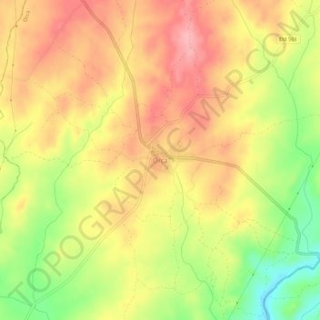
Name: Orca topographic map, elevation, terrain.
Location: Orca, Fundão, Castelo Branco, 6230-512, Portugal (40.02930 -7.38696 40.06930 -7.34696)
Average elevation: 1,198 ft
Minimum elevation: 961 ft
Maximum elevation: 1,365 ft
Thank you for supporting this site ❤️
Make a donation
Make a donation
Gear up for your next adventure:
As an Amazon Associate, this site earns from qualifying purchases at no extra cost to you.