
Thank you for supporting this site ❤️
Make a donation
Make a donation
Gear up for your next adventure:
As an Amazon Associate, this site earns from qualifying purchases at no extra cost to you.
Record topographic map
Click on the map to display elevation.
Thank you for supporting this site ❤️
Make a donation
Make a donation
Gear up for your next adventure:
As an Amazon Associate, this site earns from qualifying purchases at no extra cost to you.
About this map
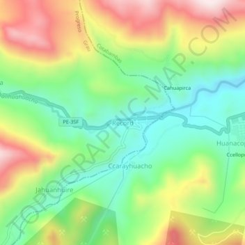
Name: Record topographic map, elevation, terrain.
Location: Record, Progreso, Grau, Apurímac, Peru (-14.16539 -72.37862 -14.12539 -72.33862)
Average elevation: 13,232 ft
Minimum elevation: 12,503 ft
Maximum elevation: 14,308 ft
Thank you for supporting this site ❤️
Make a donation
Make a donation
Gear up for your next adventure:
As an Amazon Associate, this site earns from qualifying purchases at no extra cost to you.