Geolocate

Moltrasio topographic map

Click on the map to display elevation.

About this map

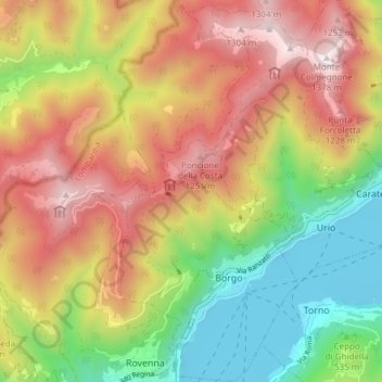
Name: Moltrasio topographic map, elevation, terrain.

Location: Moltrasio, Como, Lombardy, 22012, Italy (45.84777 9.07725 45.90040 9.11272)

Average elevation: 2,333 ft

Minimum elevation: 630 ft

Maximum elevation: 4,459 ft

Gear up for your next adventure:

🛶Inflatable Kayak - Portable kayak for rivers, lakes, and expeditions
🪶Wildlife Field Guides - Learn animal tracking and species ID
📌Outdoor GPS Map App - Apps and devices for digital topographic navigation
🪶Multi‑Purpose Knife - Useful blade for camp and trail
🪶Fire Starter Kit - Reliable fire starter for survival and camping

As an Amazon Associate, this site earns from qualifying purchases at no extra cost to you.