
Thank you for supporting this site ❤️
Make a donation
Make a donation
Gear up for your next adventure:
As an Amazon Associate, this site earns from qualifying purchases at no extra cost to you.
Nimaima topographic map
Click on the map to display elevation.
Thank you for supporting this site ❤️
Make a donation
Make a donation
Gear up for your next adventure:
As an Amazon Associate, this site earns from qualifying purchases at no extra cost to you.
About this map
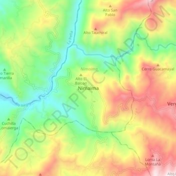
Name: Nimaima topographic map, elevation, terrain.
Location: Nimaima, Gualivá, Cundinamarca, Colombia (5.08539 -74.42535 5.16539 -74.34535)
Average elevation: 3,717 ft
Minimum elevation: 2,182 ft
Maximum elevation: 5,797 ft
Thank you for supporting this site ❤️
Make a donation
Make a donation
Gear up for your next adventure:
As an Amazon Associate, this site earns from qualifying purchases at no extra cost to you.