Geolocate

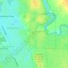
Buller topographic map

Click on the map to display elevation.

About this map

Name: Buller topographic map, elevation, terrain.

Location: Buller, Geraldton, Western Australia, Australia (-28.66785 114.60373 -28.63353 114.63651)

Average elevation: 118 ft

Minimum elevation: 0 ft

Maximum elevation: 308 ft

Other topographic maps

Click on a map to view its topography, its elevation and its terrain.
Muir Park

Australia > Western Australia > Geraldton

Average elevation: 69 ft

Gear up for your next adventure:

🧭Compass with Lanyard - Easy‑carry compass for navigation
☕Camping Coffee Makers - Enjoy premium coffee at the summit or campsite
🔥Camping Stove - Portable stove for camping and backcountry cooking
🪶Thermal Camp Blanket - Extra warmth for cold nights
🗻Climbing Gear Basics - Essential gear for beginner climbers

As an Amazon Associate, this site earns from qualifying purchases at no extra cost to you.