Geolocate

Moore topographic map

Click on the map to display elevation.

About this map

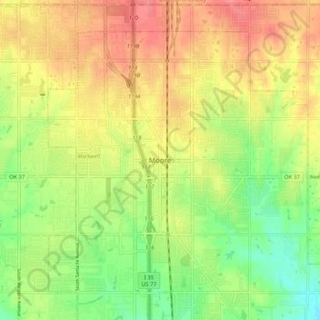
Name: Moore topographic map, elevation, terrain.

Location: Moore, Cleveland County, Oklahoma, 73160, United States (35.29833 -97.52670 35.37833 -97.44670)

Average elevation: 1,237 ft

Minimum elevation: 1,119 ft

Maximum elevation: 1,342 ft

Cleveland County trails, hiking, mountain biking, running and outdoor activities

Gear up for your next adventure:

👖Convertible Hiking Pants - Versatile zip-off pants for changing altitudes and temperatures
Backpacking Tent - Lightweight and durable tent for multi‑day hikes
🌄Hiking Binoculars - Compact binoculars for scenic views and trail spotting
📦Gear Storage Bags - Organize and protect outdoor equipment
🌡️Handheld Weather Meters - Measure wind, temp, and pressure for safe mountain travel

As an Amazon Associate, this site earns from qualifying purchases at no extra cost to you.