
Thank you for supporting this site ❤️
Make a donation
Make a donation
Gear up for your next adventure:
As an Amazon Associate, this site earns from qualifying purchases at no extra cost to you.
Mayavati topographic map
Click on the map to display elevation.
Thank you for supporting this site ❤️
Make a donation
Make a donation
Gear up for your next adventure:
As an Amazon Associate, this site earns from qualifying purchases at no extra cost to you.
About this map
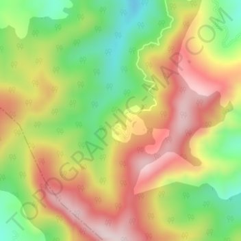
Name: Mayavati topographic map, elevation, terrain.
Location: Mayavati, Lohaghat, Champawat, Uttarakhand, India (29.36470 80.05150 29.38470 80.07150)
Average elevation: 6,152 ft
Minimum elevation: 5,528 ft
Maximum elevation: 6,755 ft
Thank you for supporting this site ❤️
Make a donation
Make a donation
Gear up for your next adventure:
As an Amazon Associate, this site earns from qualifying purchases at no extra cost to you.