
Thank you for supporting this site ❤️
Make a donation
Make a donation
Gear up for your next adventure:
As an Amazon Associate, this site earns from qualifying purchases at no extra cost to you.
bairagarh topographic map
Click on the map to display elevation.
Thank you for supporting this site ❤️
Make a donation
Make a donation
Gear up for your next adventure:
As an Amazon Associate, this site earns from qualifying purchases at no extra cost to you.
About this map
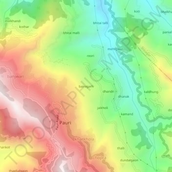
Name: bairagarh topographic map, elevation, terrain.
Location: bairagarh, Pauri, Pauri Garhwal, Uttarakhand, 246001, India (30.13646 78.76155 30.17646 78.80155)
Average elevation: 4,386 ft
Minimum elevation: 2,743 ft
Maximum elevation: 6,250 ft
Thank you for supporting this site ❤️
Make a donation
Make a donation
Gear up for your next adventure:
As an Amazon Associate, this site earns from qualifying purchases at no extra cost to you.