
Thank you for supporting this site ❤️
Make a donation
Make a donation
Gear up for your next adventure:
As an Amazon Associate, this site earns from qualifying purchases at no extra cost to you.
Cerezal topographic map
Click on the map to display elevation.
Thank you for supporting this site ❤️
Make a donation
Make a donation
Gear up for your next adventure:
As an Amazon Associate, this site earns from qualifying purchases at no extra cost to you.
About this map
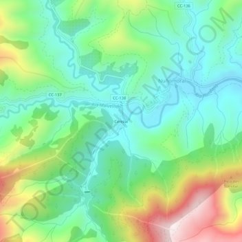
Name: Cerezal topographic map, elevation, terrain.
Location: Cerezal, Nuñomoral, Cáceres, Extremadura, 10626, España (40.38220 -6.27567 40.42220 -6.23567)
Average elevation: 2,215 ft
Minimum elevation: 1,509 ft
Maximum elevation: 3,750 ft
Thank you for supporting this site ❤️
Make a donation
Make a donation
Gear up for your next adventure:
As an Amazon Associate, this site earns from qualifying purchases at no extra cost to you.