
Winfield topographic map
Click on the map to display elevation.
About this map
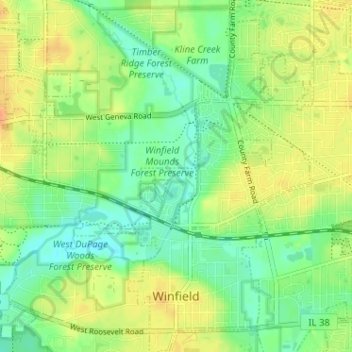
Name: Winfield topographic map, elevation, terrain.
Location: Winfield, DuPage County, Illinois, 60190, United States (41.85402 -88.17950 41.90166 -88.12459)
Average elevation: 751 ft
Minimum elevation: 699 ft
Maximum elevation: 814 ft
DuPage County trails, hiking, mountain biking, running and outdoor activities
Other topographic maps
Click on a map to view its topography, its elevation and its terrain.
Elmhurst
United States > Illinois > DuPage County
Due to local topography, the town has had a tendency to flood in the past after large rainfalls; the city is currently undertaking a large effort to mitigate future flooding.
Average elevation: 679 ft
Elmhurst
United States > Illinois > DuPage County
Due to local topography, the town has had a tendency to flood in the past after large rainfalls; the city is currently undertaking a large effort to mitigate future flooding.
Average elevation: 679 ft