Geolocate

Yaldu topographic map

Click on the map to display elevation.

About this map

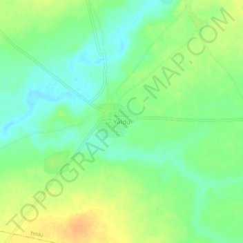
Name: Yaldu topographic map, elevation, terrain.

Location: Yaldu, Yeldu, Arewa Dandi, Kebbi State, Nigeria (12.76725 4.24703 12.80725 4.28703)

Average elevation: 751 ft

Minimum elevation: 705 ft

Maximum elevation: 807 ft

Gear up for your next adventure:

🗺️NatGeo Topo Maps - High-quality waterproof printed topographic maps of US Parks
🪶LED Camping Lantern - Bright lantern for camp lighting
🧣Hiking Neck Gaiter - Multi‑use neck protection for outdoor weather
🪶Paracord Bracelet - Survival bracelet with built‑in tools
GPS Sports Watch - GPS watch for running, hiking and training

As an Amazon Associate, this site earns from qualifying purchases at no extra cost to you.