
Dampierre-sous-Bouhy topographic map
Interactive map
Click on the map to display elevation.
About this map
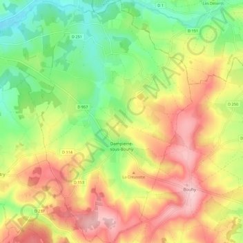
Name: Dampierre-sous-Bouhy topographic map, elevation, terrain.
Average elevation: 856 ft
Minimum elevation: 581 ft
Maximum elevation: 1,155 ft
Other topographic maps
Click on a map to view its topography, its elevation and its terrain.
Montgirault
France > Bourgogne-Franche-Comté > Nièvre > Montsauche-les-Settons
Average elevation: 1,814 ft