
Thank you for supporting this site ❤️
Make a donation
Make a donation
Gear up for your next adventure:
As an Amazon Associate, this site earns from qualifying purchases at no extra cost to you.
Kuno topographic map
Click on the map to display elevation.
Thank you for supporting this site ❤️
Make a donation
Make a donation
Gear up for your next adventure:
As an Amazon Associate, this site earns from qualifying purchases at no extra cost to you.
About this map
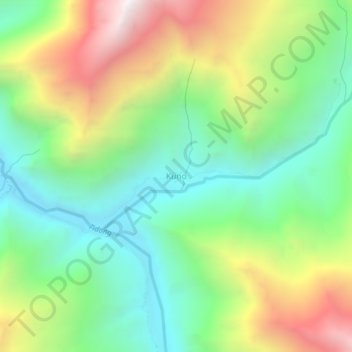
Name: Kuno topographic map, elevation, terrain.
Location: Kuno, Moorang, Kinnaur district, Himachal Pradesh, India (31.44670 78.55368 31.48670 78.59368)
Average elevation: 13,143 ft
Minimum elevation: 11,217 ft
Maximum elevation: 16,407 ft
Thank you for supporting this site ❤️
Make a donation
Make a donation
Gear up for your next adventure:
As an Amazon Associate, this site earns from qualifying purchases at no extra cost to you.