
Nebraska City topographic map
Interactive map
Click on the map to display elevation.
About this map
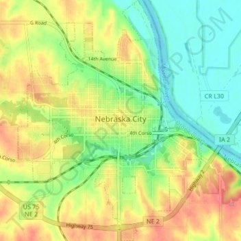
Name: Nebraska City topographic map, elevation, terrain.
Location: Nebraska City, Otoe County, Nebraska, United States (40.65050 -95.88762 40.70180 -95.83596)
Average elevation: 1,014 ft
Minimum elevation: 902 ft
Maximum elevation: 1,152 ft
Otoe County trails, hiking, mountain biking, running and outdoor activities