
Saint Peter Parish topographic map
Interactive map
Click on the map to display elevation.
About this map
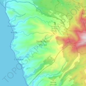
Name: Saint Peter Parish topographic map, elevation, terrain.
Location: Saint Peter Parish, Dominica (15.46191 -61.47496 15.53760 -61.39735)
Average elevation: 1,293 ft
Minimum elevation: -3 ft
Maximum elevation: 4,564 ft
Other topographic maps
Click on a map to view its topography, its elevation and its terrain.