
Gloucester Point topographic map
Interactive map
Click on the map to display elevation.
About this map
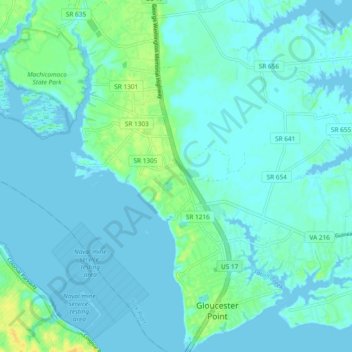
Name: Gloucester Point topographic map, elevation, terrain.
Location: Gloucester Point, Gloucester County, Virginia, United States (37.24527 -76.53616 37.32002 -76.44564)
Average elevation: 16 ft
Minimum elevation: -7 ft
Maximum elevation: 75 ft
Gloucester County trails, hiking, mountain biking, running and outdoor activities
Other topographic maps
Click on a map to view its topography, its elevation and its terrain.
Thousand Trails Chesapeake Bay RV Resort
United States > Virginia > Gloucester County
Average elevation: 33 ft