
Union topographic map
Interactive map
Click on the map to display elevation.
About this map
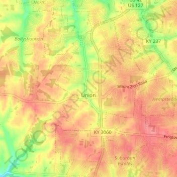
Name: Union topographic map, elevation, terrain.
Location: Union, Boone County, Kentucky, 41091, United States (38.92267 -84.69260 38.97267 -84.64923)
Average elevation: 869 ft
Minimum elevation: 722 ft
Maximum elevation: 951 ft
Boone County trails, hiking, mountain biking, running and outdoor activities
Other topographic maps
Click on a map to view its topography, its elevation and its terrain.