
Pretty River Valley Provincial Park topographic map
Interactive map
Click on the map to display elevation.
About this map
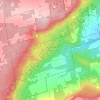
Name: Pretty River Valley Provincial Park topographic map, elevation, terrain.
Average elevation: 1,371 ft
Minimum elevation: 879 ft
Maximum elevation: 1,742 ft
Other topographic maps
Click on a map to view its topography, its elevation and its terrain.
Castle Glen Estates
Canada > Ontario > Grey County > The Blue Mountains
Castle Glen Estates, The Blue Mountains, Grey County, Ontario, L9Y 0P1, Canada
Average elevation: 1,490 ft
Heathcote
Canada > Ontario > Grey County > The Blue Mountains
Heathcote, The Blue Mountains, Grey County, Southwestern Ontario, Ontario, Canada
Average elevation: 850 ft
Blue Mountains
Canada > Ontario > Grey County > The Blue Mountains
Blue Mountains, The Blue Mountains, Grey County, Ontario, N0H 2E0, Canada
Average elevation: 1,496 ft