
Heathcote topographic map
Click on the map to display elevation.
About this map
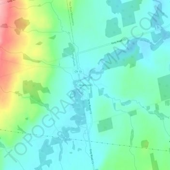
Name: Heathcote topographic map, elevation, terrain.
Average elevation: 850 ft
Minimum elevation: 732 ft
Maximum elevation: 1,204 ft
Other topographic maps
Click on a map to view its topography, its elevation and its terrain.
Pretty River Valley Provincial Park
Canada > Ontario > Grey County > The Blue Mountains
Average elevation: 1,371 ft
Craigleith Provincial Park
Canada > Ontario > Grey County > The Blue Mountains
Average elevation: 705 ft