
Brooklyn topographic map
Interactive map
Click on the map to display elevation.
About this map
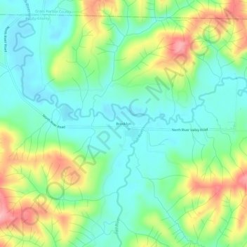
Name: Brooklyn topographic map, elevation, terrain.
Location: Brooklyn, Pacific County, Washington, United States (46.75621 -123.52988 46.79621 -123.48988)
Average elevation: 344 ft
Minimum elevation: 151 ft
Maximum elevation: 728 ft
Pacific County trails, hiking, mountain biking, running and outdoor activities
Other topographic maps
Click on a map to view its topography, its elevation and its terrain.