Geolocate

Cork City topographic map

Interactive map

Click on the map to display elevation.

About this map

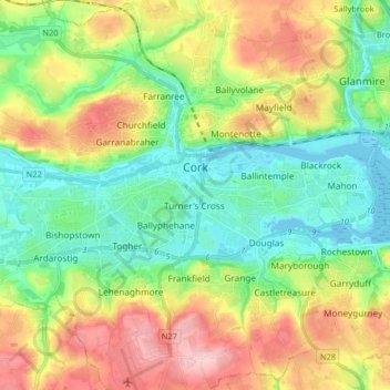
Name: Cork City topographic map, elevation, terrain.

Location: Cork City, Cork, County Cork, Munster, Ireland (51.84230 -8.55200 51.93729 -8.38936)

Average elevation: 217 ft

Minimum elevation: -10 ft

Maximum elevation: 581 ft

Other topographic maps

Click on a map to view its topography, its elevation and its terrain.

Kilcully

Ireland > County Cork > Cork

Kilcully, Rathcooney, Cork, County Cork, Munster, T23 HP30, Ireland

Average elevation: 272 ft

Lee Fields

Ireland > County Cork > Cork

Lee Fields, Bishopstown ED A, Cork, County Cork, Munster, Ireland

Average elevation: 161 ft

Douglas

Ireland > County Cork > Cork

Douglas, Cork, County Cork, Munster, Ireland

Average elevation: 112 ft