
Ballincollig topographic map
Click on the map to display elevation.
About this map
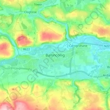
Name: Ballincollig topographic map, elevation, terrain.
Location: Ballincollig, Cork, County Cork, Munster, P31 TW88, Ireland (51.84834 -8.62940 51.92834 -8.54940)
Average elevation: 203 ft
Minimum elevation: 7 ft
Maximum elevation: 650 ft
Other topographic maps
Click on a map to view its topography, its elevation and its terrain.