
Vernon topographic map
Interactive map
Click on the map to display elevation.
About this map
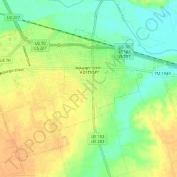
Name: Vernon topographic map, elevation, terrain.
Location: Vernon, Wilbarger County, Texas, 76384, United States (34.12116 -99.33265 34.16993 -99.25805)
Average elevation: 1,224 ft
Minimum elevation: 1,171 ft
Maximum elevation: 1,273 ft
Wilbarger County trails, hiking, mountain biking, running and outdoor activities
Other topographic maps
Click on a map to view its topography, its elevation and its terrain.