
Prince Edward Island topographic map
Interactive map
Click on the map to display elevation.
About this map
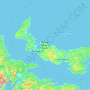
Name: Prince Edward Island topographic map, elevation, terrain.
Location: Prince Edward Island, Canada (45.94829 -64.41380 47.05897 -61.97077)
Average elevation: 43 ft
Minimum elevation: -10 ft
Maximum elevation: 1,289 ft
Other topographic maps
Click on a map to view its topography, its elevation and its terrain.
Dunedin
Canada > Prince Edward Island > Rural Municipality of Clyde River > Clyde River
Average elevation: 72 ft