
Harstine Island topographic map
Interactive map
Click on the map to display elevation.
About this map
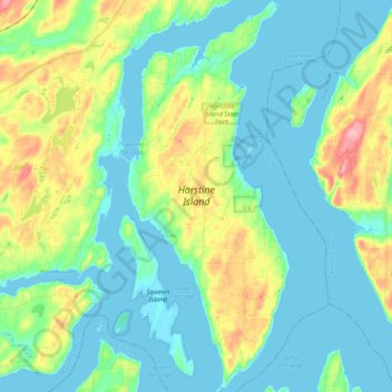
Name: Harstine Island topographic map, elevation, terrain.
Location: Harstine Island, Mason County, Washington, United States (47.16270 -122.92585 47.30175 -122.84148)
Average elevation: 98 ft
Minimum elevation: -7 ft
Maximum elevation: 377 ft
Mason County trails, hiking, mountain biking, running and outdoor activities
Other topographic maps
Click on a map to view its topography, its elevation and its terrain.