
Vadnais Heights topographic map
Click on the map to display elevation.
About this map
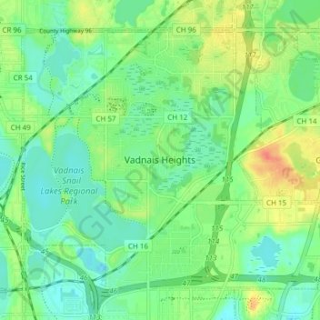
Name: Vadnais Heights topographic map, elevation, terrain.
Average elevation: 915 ft
Minimum elevation: 863 ft
Maximum elevation: 1,014 ft
Ramsey County trails, hiking, mountain biking, running and outdoor activities
Other topographic maps
Click on a map to view its topography, its elevation and its terrain.
Ford Dam Scenic Overlook
United States > Minnesota > Ramsey County > Saint Paul
Average elevation: 823 ft