Albany topographic map
Interactive map
Click on the map to display elevation.
About this map
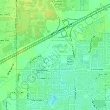
Name: Albany topographic map, elevation, terrain.
Location: Albany, Edmonton, St. Albert (city), Alberta, Canada (53.62872 -113.56283 53.63613 -113.54119)
Average elevation: 2,247 ft
Minimum elevation: 2,218 ft
Maximum elevation: 2,280 ft
Other topographic maps
Click on a map to view its topography, its elevation and its terrain.
Lake District
Lake District, Edmonton, Alberta, Canada
Average elevation: 2,244 ft
Lakewood
Canada > Alberta > Edmonton > Mill Woods
Lakewood, Mill Woods, Edmonton, Alberta, Canada
Average elevation: 2,260 ft
The Meadows District
Larkspur, West Meadows, The Meadows District, Edmonton, Alberta, Canada
Average elevation: 2,320 ft
Central Core
Downtown, Central Core, Edmonton, Alberta, Canada
Average elevation: 2,142 ft
The Meadows
Tamarack, The Meadows, Edmonton, Alberta, Canada
Average elevation: 2,356 ft