
Osawatomie topographic map
Interactive map
Click on the map to display elevation.
About this map
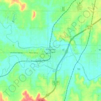
Name: Osawatomie topographic map, elevation, terrain.
Location: Osawatomie, Miami County, Kansas, 66064, United States (38.46252 -95.00203 38.53877 -94.89058)
Average elevation: 896 ft
Minimum elevation: 827 ft
Maximum elevation: 1,073 ft
Miami County trails, hiking, mountain biking, running and outdoor activities
Other topographic maps
Click on a map to view its topography, its elevation and its terrain.