
Saratoga topographic map
Interactive map
Click on the map to display elevation.
About this map
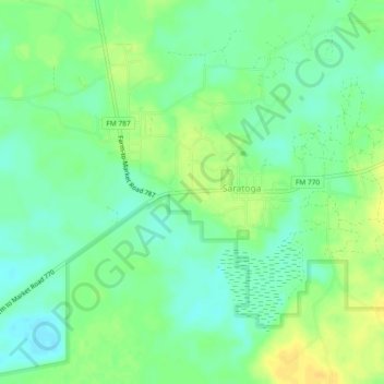
Name: Saratoga topographic map, elevation, terrain.
Location: Saratoga, Hardin County, Texas, 77585, United States (30.26455 -94.54339 30.30455 -94.50339)
Average elevation: 82 ft
Minimum elevation: 43 ft
Maximum elevation: 121 ft
Hardin County trails, hiking, mountain biking, running and outdoor activities
Other topographic maps
Click on a map to view its topography, its elevation and its terrain.