
Perry topographic map
Interactive map
Click on the map to display elevation.
About this map
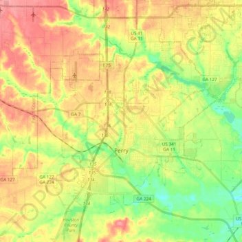
Name: Perry topographic map, elevation, terrain.
Location: Perry, Houston County, Georgia, 31069, United States (32.41637 -83.79762 32.53944 -83.60786)
Average elevation: 364 ft
Minimum elevation: 233 ft
Maximum elevation: 492 ft
Other topographic maps
Click on a map to view its topography, its elevation and its terrain.
Robins Air Force Base
United States > Georgia > Houston County
Robins Air Force Base, Houston County, Georgia, 31098, United States
Average elevation: 302 ft
Warner Robins
United States > Georgia > Houston County
Warner Robins, Houston County, Georgia, United States
Average elevation: 331 ft
Centerville
United States > Georgia > Houston County
Centerville, Houston County, Georgia, 31028, United States
Average elevation: 446 ft
Bonaire
United States > Georgia > Houston County
Bonaire, Houston County, Georgia, 31005, United States
Average elevation: 328 ft
Warner Robins
United States > Georgia > Houston County > Warner Robins
Warner Robins, Houston County, Georgia, 31098, United States
Average elevation: 358 ft