
Middlesex topographic map
Interactive map
Click on the map to display elevation.
About this map
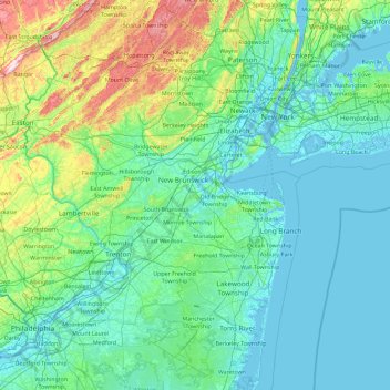
Name: Middlesex topographic map, elevation, terrain.
Location: Middlesex, New Jersey, 08816, United States of America (39.72797 -75.09631 41.12797 -73.69631)
Average elevation: 217 ft
Minimum elevation: -16 ft
Maximum elevation: 1,683 ft
Other topographic maps
Click on a map to view its topography, its elevation and its terrain.
Millstone Township
United States of America > New Jersey > Millstone Township
Average elevation: 161 ft
Independence National Historical Park
United States of America > New Jersey > Camden
Average elevation: 39 ft