
Newnan topographic map
Interactive map
Click on the map to display elevation.
About this map
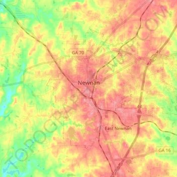
Name: Newnan topographic map, elevation, terrain.
Location: Newnan, Coweta County, Georgia, United States (33.33735 -84.83289 33.41625 -84.69393)
Average elevation: 892 ft
Minimum elevation: 722 ft
Maximum elevation: 1,020 ft
Coweta County trails, hiking, mountain biking, running and outdoor activities
Other topographic maps
Click on a map to view its topography, its elevation and its terrain.