
Cedar Grove topographic map
Interactive map
Click on the map to display elevation.
About this map
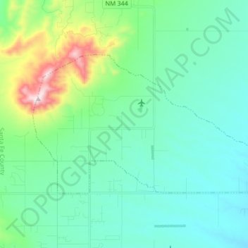
Name: Cedar Grove topographic map, elevation, terrain.
Location: Cedar Grove, Santa Fe County, New Mexico, United States (35.14185 -106.22259 35.20411 -106.08674)
Average elevation: 6,844 ft
Minimum elevation: 6,371 ft
Maximum elevation: 8,750 ft
Santa Fe County trails, hiking, mountain biking, running and outdoor activities
Other topographic maps
Click on a map to view its topography, its elevation and its terrain.