
Ceres topographic map
Interactive map
Click on the map to display elevation.
About this map
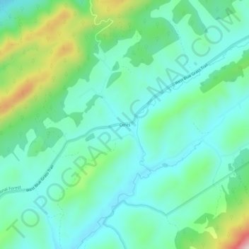
Name: Ceres topographic map, elevation, terrain.
Location: Ceres, Bland County, Virginia, United States (36.99789 -81.36288 37.03789 -81.32288)
Average elevation: 2,795 ft
Minimum elevation: 2,497 ft
Maximum elevation: 3,707 ft
Other topographic maps
Click on a map to view its topography, its elevation and its terrain.
Suiter
United States > Virginia > Bland County
Suiter, Bland County, Virginia, 24314, United States
Average elevation: 2,762 ft
Grapefield
United States > Virginia > Bland County > Grapefield
Grapefield, Bland County, Virginia, 24314, United States
Average elevation: 2,697 ft